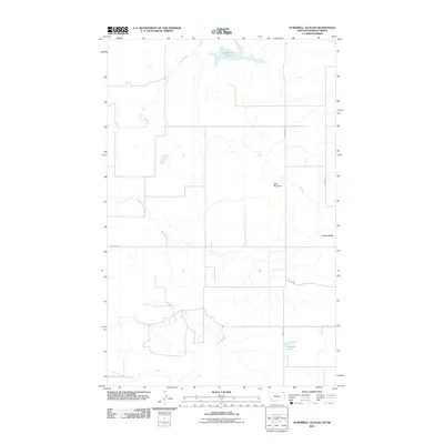
2011 Map of Si Merrell Slough
USGS Topo · Published 2011About this map
Si Merrell Slough and its drainages define this remote borderland landscape where the Montana plains meet the Canadian boundary. The 2011 survey reveals a sparse network of section-line roads such as N. Madoc Rd and Rubin Rd that service a series of small water management features and isolated landmarks. The presence of Baby Blue Dam and Paradis Pond indicates the ongoing importance of water collection in this arid ranching environment. To the east, the prominent elevation of Square Butte stands as a clear navigational point above the winding courses of Outlet Creek and Whitetail Creek. The map documents a quiet period of rural land use, where the grid of the Public Land Survey System dictates the movement of travel and the boundaries of large agricultural holdings.
Find a feature on this map
9 named features on this map. Tap any name to fly to it.
Don’t see what you’re looking for? This feature index may not catch every label — zoom into the map to look around manually.
Map Details
Editions of this 2011 Si Merrell Slough Map
This is the sole edition of this map. No revisions or reprints were ever made.
Other maps of this area

1954 · Wolf Point
USGS Topo · 1:250,000

1958 · Wolf Point
USGS Topo · 1:250,000

1973 · Madoc
USGS Topo · 1:24,000

1973 · Flaxville
USGS Topo · 1:24,000

1973 · Whitetail
USGS Topo · 1:24,000

1973 · Scobey
USGS Topo · 1:24,000

1973 · Scobey NW
USGS Topo · 1:24,000

1973 · Si Merrell Slough
USGS Topo · 1:24,000

1983 · Scobey
USGS Topo · 1:100,000
2011 · Madoc
USGS Topo · 1:24,000