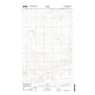
2014 Map of Si Merrell Slough
USGS Topo · Published 2014About this map
Si Merrell Slough sits at the northern edge of this high-plains landscape, crossing the international border between United States of America and Canada. The terrain is defined by its drainage patterns and isolated high points, where Outlet Cr flows through the western reaches while Rubin Butte and Square Butte rise above the surrounding flats in the east. This region reflects the systematic organization of the Public Land Survey System, with a regular grid of section lines and gravel roads such as Outlet Creek Rd and Julian Rd providing access across the rolling prairie. To the south, the presence of Paradis Pond and the headwaters of Whitetail Cr near E Charley Creek Rd indicate the vital role of seasonal water sources in this dry ranching and farming environment.
Find a feature on this map
22 named features on this map. Tap any name to fly to it.
Don’t see what you’re looking for? This feature index may not catch every label — zoom into the map to look around manually.
Map Details
Editions of this 2014 Si Merrell Slough Map
This is the sole edition of this map. No revisions or reprints were ever made.
Other maps of this area

1954 · Wolf Point
USGS Topo · 1:250,000

1958 · Wolf Point
USGS Topo · 1:250,000

1973 · Madoc
USGS Topo · 1:24,000

1973 · Flaxville
USGS Topo · 1:24,000

1973 · Whitetail
USGS Topo · 1:24,000

1973 · Scobey
USGS Topo · 1:24,000

1973 · Scobey NW
USGS Topo · 1:24,000

1973 · Si Merrell Slough
USGS Topo · 1:24,000

1983 · Scobey
USGS Topo · 1:100,000
2011 · Si Merrell Slough
USGS Topo · 1:24,000