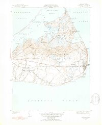
1951 Map of Siasconset
USGS Topo · Published 1952About this map
Siasconset and the eastern reaches of the island are captured here during a period of postwar transition, showing the intersection of traditional seafaring life and modern infrastructure. The village of Codfish Park sits at the water's edge below the bluffs, while the Abandoned Railroad Grade cutting across the island serves as a reminder of the rail link that once connected these outposts to the main town. Local industry is represented by the large Cranberry Bog near Gibbs Pond, reflecting the agricultural heritage that persisted alongside the growing recreational landscape seen at the Sankaty Golf Course.
Find a feature on this map
64 named features on this map. Tap any name to fly to it.
Don’t see what you’re looking for? This feature index may not catch every label — zoom into the map to look around manually.
Map Details
Editions of this 1951 Siasconset Map
4 editions found
Other maps of this area

1889 · Nantucket
USGS Topo · 1:62,500

1893 · Nantucket
USGS Topo · 1:62,500

1901 · Nantucket
USGS Topo · 1:62,500

1942 · Nantucket
USGS Topo · 1:125,000

1945 · Nantucket
USGS Topo · 1:31,680

1945 · Siasconset
USGS Topo · 1:31,680

1945 · Great Point
USGS Topo · 1:31,680

1947 · Providence
USGS Topo · 1:250,000

1948 · Providence
USGS Topo · 1:250,000

1951 · Great Point
USGS Topo · 1:31,680