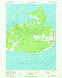
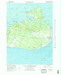
1972 Map of Siasconset
USGS Topo · Published 1973About this map
The eastern reaches of Nantucket Sound meet the open Atlantic Ocean in this 1970s record of eastern Nantucket. The settlement of Siasconset anchors the southeastern coast, characterized by its distinctive radial road pattern and proximity to Sankaty Head, where the Lighthouse stands atop the bluff. The interior landscape is dominated by the Saul's Hills, a series of elevations including Altar Rock and Folger Hill, which overlook a network of bogs and glacial ponds such as Gibbs Pond.
Find a feature on this map
82 named features on this map. Tap any name to fly to it.
Don’t see what you’re looking for? This feature index may not catch every label — zoom into the map to look around manually.
Map Details
Editions of this 1972 Siasconset Map
5 editions found
Other maps of this area

1889 · Nantucket
USGS Topo · 1:62,500

1893 · Nantucket
USGS Topo · 1:62,500

1901 · Nantucket
USGS Topo · 1:62,500

1942 · Nantucket
USGS Topo · 1:125,000

1945 · Nantucket
USGS Topo · 1:31,680

1945 · Siasconset
USGS Topo · 1:31,680

1945 · Great Point
USGS Topo · 1:31,680

1947 · Providence
USGS Topo · 1:250,000

1948 · Providence
USGS Topo · 1:250,000

1951 · Great Point
USGS Topo · 1:31,680