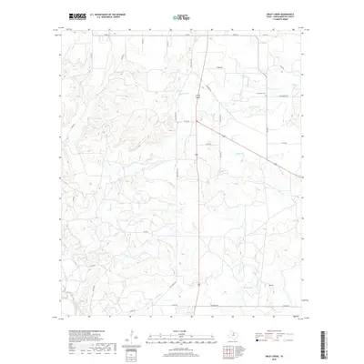
2019 Map of Sibley Creek
USGS Topo · Published 2019About this map
Bush Knob Cr and Sibley Cr define the drainage patterns across this portion of Throckmorton County, where the landscape is etched by numerous branches and creeks. The rural character of the region is evident in the sparse settlement pattern, with Mt Air serving as a localized point of interest in the southeast. Historical travel and commerce are traced through a network of ranch-to-market roads and the prominent Old Albany Rd, which cuts north-south through the center of the sheet. Genealogists may find particular value in the location of the Bush Knob Cem near the intersection of FM 923 E and Co RD 310. The presence of several named water features like Givens Cr, Brown Lake, and Stagestand Br highlights the importance of water management in this dry Texas terrain.
Find a feature on this map
35 named features on this map. Tap any name to fly to it.
Don’t see what you’re looking for? This feature index may not catch every label — zoom into the map to look around manually.
Map Details
Editions of this 2019 Sibley Creek Map
This is the sole edition of this map. No revisions or reprints were ever made.
Other maps of this area

1892 · Albany
USGS Topo · 1:125,000

1893 · Albany
USGS Topo · 1:125,000

1954 · Abilene
USGS Topo · 1:250,000

1954 · Wichita Falls
USGS Topo · 1:250,000

1958 · Wichita Falls
USGS Topo · 1:250,000

1958 · Abilene
USGS Topo · 1:250,000

1965 · Collins Creek
USGS Topo · 1:24,000

1965 · Lusk
USGS Topo · 1:24,000

1965 · Fort Griffin
USGS Topo · 1:24,000

1965 · Throckmorton NE
USGS Topo · 1:24,000