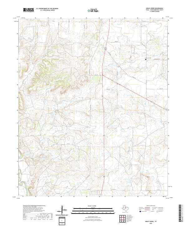
2022 Map of Sibley Creek
USGS Topo · Published 2022About this map
The Clear Fork Brazos River winds through the southwestern corner of this Throckmorton County landscape, a region defined by its complex network of creeks and intermittent streams. Central to this topography is Sibley Cr, which carves through the central terrain alongside other drainages like Bush Knob Cr, Givens Cr, and Kings Cr. The area is largely characterized by a rural road network of farm-to-market and county roads, including Old Albany Rd and Condron Rd, which connect isolated properties and ranch lands. Notable landmarks include the Bush Knob Cem in the northeast and the elevation of Mt Air to the southeast. The drainage pattern here, including Plum Br and Stagestand Br, reveals a landscape deeply influenced by the Brazos watershed, where small surface features like Brown Lake provide vital water points in the ranching country.
Find a feature on this map
34 named features on this map. Tap any name to fly to it.
Don’t see what you’re looking for? This feature index may not catch every label — zoom into the map to look around manually.
Map Details
Editions of this 2022 Sibley Creek Map
This is the sole edition of this map. No revisions or reprints were ever made.
Other maps of this area

1892 · Albany
USGS Topo · 1:125,000

1893 · Albany
USGS Topo · 1:125,000

1954 · Abilene
USGS Topo · 1:250,000

1954 · Wichita Falls
USGS Topo · 1:250,000

1958 · Wichita Falls
USGS Topo · 1:250,000

1958 · Abilene
USGS Topo · 1:250,000

1965 · Collins Creek
USGS Topo · 1:24,000

1965 · Lusk
USGS Topo · 1:24,000

1965 · Fort Griffin
USGS Topo · 1:24,000

1965 · Throckmorton NE
USGS Topo · 1:24,000