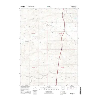
2015 Map of Sibley Peak
USGS Topo · Published 2015About this map
Sibley Peak and Anvil Peak dominate the topography of this Platte County landscape just south of the town of Glendo. The area is defined by the complex drainage system of Horseshoe Cr and its tributaries, including Spring Cr and Whiskey Gulch, which flow toward the eastern reaches of the Glendo Reservoir. For local historians and genealogists, the Horseshoe Cem remains a significant landmark near the center of the survey.
Find a feature on this map
24 named features on this map. Tap any name to fly to it.
Don’t see what you’re looking for? This feature index may not catch every label — zoom into the map to look around manually.
Map Details
Editions of this 2015 Sibley Peak Map
This is the sole edition of this map. No revisions or reprints were ever made.
Other maps of this area

1896 · Hartville
USGS Topo · 1:125,000

1901 · Hartville
USGS Topo · 1:125,000

1949 · Cedar Hill
USGS Topo · 1:24,000

1949 · Spring Creek
USGS Topo · 1:24,000

1950 · Glendo
USGS Topo · 1:24,000

1950 · Spring Creek
USGS Topo · 1:24,000

1950 · Jewel Springs
USGS Topo · 1:24,000

1950 · Coleman Butte
USGS Topo · 1:24,000

1950 · Herman Ranch
USGS Topo · 1:24,000

1950 · Cottonwood Falls
USGS Topo · 1:24,000