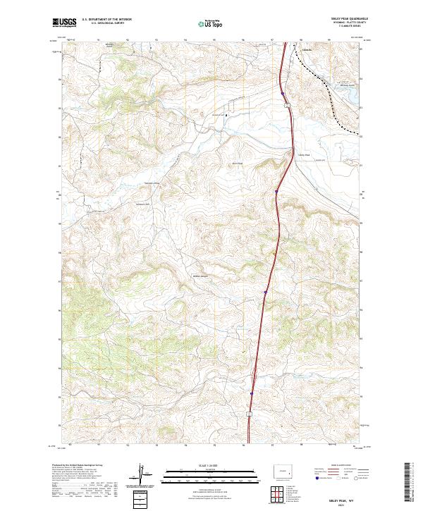
2021 Map of Sibley Peak
USGS Topo · Published 2021About this map
The town of Glendo occupies the northeastern corner of this Platte County landscape, where the high plains meet the intricate drainage systems of the Laramie Range foothills. The terrain is defined by a network of seasonal and perennial waters, including the winding Horseshoe Cr and the deeply cut Bobcat Canyon. Prominent landmarks such as Sibley Peak, Anvil Peak, and Sommers Hill provide significant vertical relief against the surrounding draws.
Find a feature on this map
27 named features on this map. Tap any name to fly to it.
Don’t see what you’re looking for? This feature index may not catch every label — zoom into the map to look around manually.
Map Details
Editions of this 2021 Sibley Peak Map
This is the sole edition of this map. No revisions or reprints were ever made.
Other maps of this area

1896 · Hartville
USGS Topo · 1:125,000

1901 · Hartville
USGS Topo · 1:125,000

1949 · Cedar Hill
USGS Topo · 1:24,000

1949 · Spring Creek
USGS Topo · 1:24,000

1950 · Glendo
USGS Topo · 1:24,000

1950 · Spring Creek
USGS Topo · 1:24,000

1950 · Jewel Springs
USGS Topo · 1:24,000

1950 · Coleman Butte
USGS Topo · 1:24,000

1950 · Herman Ranch
USGS Topo · 1:24,000

1950 · Cottonwood Falls
USGS Topo · 1:24,000