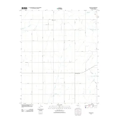
2012 Map of Sickles
USGS Topo · Published 2012About this map
Sickles defines this portion of Caddo County, situated within a landscape carved by the north-south drainage of Willow Cr and the eastern flow of Keechi Cr. This 2012 survey illustrates the grid-based settlement pattern of the Oklahoma plains, where agricultural life is anchored by central landmarks like the Sickles Cem and the small aviation hub at King Airport. To the northeast, the Lookeba Cem and the Sugar Cr Site 39 Reservoir provide further evidence of the region's managed water resources and long-standing community sites. The map effectively documents the intersection of rural infrastructure and natural hydrology, from the small basin of Hunt Lake to the extensive county road system that connects these isolated Oklahoma settlements.
Find a feature on this map
26 named features on this map. Tap any name to fly to it.
Don’t see what you’re looking for? This feature index may not catch every label — zoom into the map to look around manually.
Map Details
Editions of this 2012 Sickles Map
This is the sole edition of this map. No revisions or reprints were ever made.
Other maps of this area

1951 · Binger
USGS Topo · 1:62,500

1951 · Fort Cobb
USGS Topo · 1:62,500

1955 · Clinton
USGS Topo · 1:250,000

1957 · Clinton
USGS Topo · 1:250,000

1961 · Eakly
USGS Topo · 1:62,500

1961 · Carnegie
USGS Topo · 1:62,500

1979 · Hinton
USGS Topo · 1:24,000

1979 · Sickles
USGS Topo · 1:24,000
1979 · Fort Cobb Dam
USGS Topo · 1:24,000
1979 · Binger
USGS Topo · 1:24,000