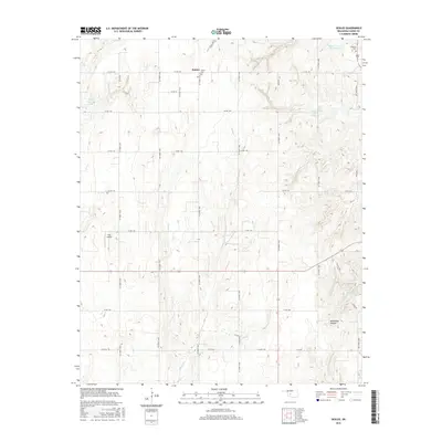
2016 Map of Sickles
USGS Topo · Published 2016About this map
Sickles serves as the central focal point of this Caddo County landscape, surrounded by an intricate network of section-line roads such as Co RD 1140 and Co Street 2550. The area is defined by its water management and agricultural layout, featuring several reservoirs including Sugar Cr Site 39 Reservoir and Sugar Creek Site 10 Reservoir that dot the drainages of Willow Cr and Keechi Cr. For those researching local heritage, the map identifies the Sickles Cem and Lookeba Cem, providing essential points of interest for genealogical study.
Find a feature on this map
35 named features on this map. Tap any name to fly to it.
Don’t see what you’re looking for? This feature index may not catch every label — zoom into the map to look around manually.
Map Details
Editions of this 2016 Sickles Map
This is the sole edition of this map. No revisions or reprints were ever made.
Other maps of this area

1951 · Binger
USGS Topo · 1:62,500

1951 · Fort Cobb
USGS Topo · 1:62,500

1955 · Clinton
USGS Topo · 1:250,000

1957 · Clinton
USGS Topo · 1:250,000

1961 · Eakly
USGS Topo · 1:62,500

1961 · Carnegie
USGS Topo · 1:62,500

1979 · Hinton
USGS Topo · 1:24,000

1979 · Sickles
USGS Topo · 1:24,000
1979 · Fort Cobb Dam
USGS Topo · 1:24,000
1979 · Binger
USGS Topo · 1:24,000