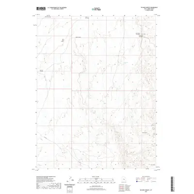
2020 Map of Sid And Charley
USGS Topo · Published 2020About this map
Sid and Charley, a distinctive pillar-like formation, dominates the western landscape of this Emery County region. The terrain is defined by deep incisions and high plateaus, most notably Eagle Canyon and the massive southern Secret Mesa. These landforms are etched by a complex network of seasonal drainage systems, including Red Hole Draw and North Salt Wash, while Cottonwood Spring provides a rare point of named hydrography in the arid interior. To the northeast, the convergence of North Fork Coal Wash and South Fork Coal Wash illustrates the erosive power that has shaped The Red Ledges. Access through this formidable topography is limited to sparse secondary routes such as Co RD 803, highlighting the area's isolation and reliance on established desert corridors.
Find a feature on this map
12 named features on this map. Tap any name to fly to it.
Don’t see what you’re looking for? This feature index may not catch every label — zoom into the map to look around manually.
Map Details
Editions of this 2020 Sid And Charley Map
This is the sole edition of this map. No revisions or reprints were ever made.
Other maps of this area

1885 · San Rafael
USGS Topo · 1:250,000

1885 · Manti
USGS Topo · 1:250,000

1885 · Fish Lake
USGS Topo · 1:250,000

1886 · Price River
USGS Topo · 1:250,000

1895 · Manti
USGS Topo · 1:250,000

1896 · Price River
USGS Topo · 1:250,000

1896 · Fish Lake
USGS Topo · 1:250,000

1923 · Castle Dale
USGS Topo · 1:62,500

1925 · Castle Dale
USGS Topo · 1:62,500

1952 · San Rafael Knob
USGS Topo · 1:62,500