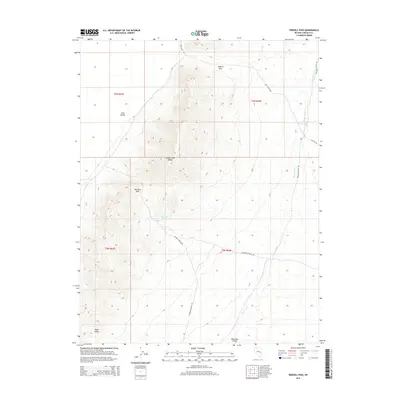
2014 Map of Sidehill Pass
USGS Topo · Published 2014About this map
Schell Creek Range dominates the central topography of this Nevada landscape, creating a natural divide between several distinct basins. The high terrain is punctuated by Sidehill Pass and Big Mud Pass, which serve as the primary conduits for travel across the ridge. This modern survey illustrates how historical routes have evolved into named thoroughfares like Cave Valley Rd and Muleshoe Valley Rd, connecting the scattered water sources and flatlands of Cave Valley and Muleshoe Valley. A critical water feature, Big Mud Springs, is situated near the southern base of the range, likely acting as a historical landmark for travelers and livestock in an otherwise arid environment. The map provides a detailed view of the drainage patterns, particularly along Coyote Wash, which carves through the eastern sections of the quadrangle toward the southern Piute Valley.
Find a feature on this map
16 named features on this map. Tap any name to fly to it.
Don’t see what you’re looking for? This feature index may not catch every label — zoom into the map to look around manually.
Map Details
Editions of this 2014 Sidehill Pass Map
This is the sole edition of this map. No revisions or reprints were ever made.
Other maps of this area

1915 · Bristol Range
USGS Topo · 1:62,500

1917 · Bristol Range
USGS Topo · 1:62,500

1956 · Lund
USGS Topo · 1:250,000

1960 · Lund
USGS Topo · 1:250,000

1971 · Sidehill Spring
USGS Topo · 1:24,000

1971 · Bailey Wash
USGS Topo · 1:24,000
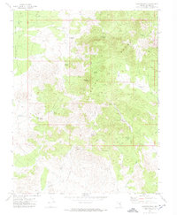
1971 · Fairview Peak
USGS Topo · 1:24,000

1971 · Cave Valley Well
USGS Topo · 1:24,000

1971 · Silver King Mtn
USGS Topo · 1:24,000

1971 · Sidehill Pass
USGS Topo · 1:24,000