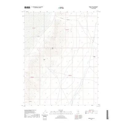
2018 Map of Sidehill Pass
USGS Topo · Published 2018About this map
Schell Creek Range dominates this portion of Lincoln County, defining the high-altitude divide between several prominent desert basins. The terrain transitions sharply from the broad reaches of Cave Valley and Piute Valley in the west to the higher elevations of the mountains. Critical natural water sources are sparse in this arid landscape, making Big Mud Springs a vital landmark near the center of the range. Transportation through this remote topography is limited to rugged passages such as Sidehill Pass and Big Mud Pass, which provide the only viable routes for S Cave Valley Rd to navigate the steep contours. To the east, the landscape opens again into Muleshoe Valley, where the ephemeral drainage of Coyote Wash marks the low-lying floor of the basin.
Find a feature on this map
13 named features on this map. Tap any name to fly to it.
Don’t see what you’re looking for? This feature index may not catch every label — zoom into the map to look around manually.
Map Details
Editions of this 2018 Sidehill Pass Map
This is the sole edition of this map. No revisions or reprints were ever made.
Other maps of this area

1915 · Bristol Range
USGS Topo · 1:62,500

1917 · Bristol Range
USGS Topo · 1:62,500

1956 · Lund
USGS Topo · 1:250,000

1960 · Lund
USGS Topo · 1:250,000

1971 · Sidehill Spring
USGS Topo · 1:24,000

1971 · Bailey Wash
USGS Topo · 1:24,000
1971 · Fairview Peak
USGS Topo · 1:24,000

1971 · Cave Valley Well
USGS Topo · 1:24,000

1971 · Silver King Mtn
USGS Topo · 1:24,000

1971 · Sidehill Pass
USGS Topo · 1:24,000