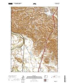
2020 Map of Sidney
USGS Topo · Published 2020About this map
Salem sits at the northern edge of this landscape where the valley floor begins its climb into the Salem Hills. The terrain is defined by a series of prominent rises including Jory Hill, Bunker Hill, and Ankeny Hill, which overlook the fertile stretches of Ankeny Bottom and American Bottom along the Willamette River. This 2020 survey documents the complex intersection of modern infrastructure, such as Interstate 5, and the enduring agricultural character of southern Marion County.
Find a feature on this map
55 named features on this map. Tap any name to fly to it.
Don’t see what you’re looking for? This feature index may not catch every label — zoom into the map to look around manually.
Map Details
Editions of this 2020 Sidney Map
This is the sole edition of this map. No revisions or reprints were ever made.
Other maps of this area

1912 · Jefferson
USGS Topo · 1:31,680

1913 · Wells
USGS Topo · 1:31,680

1914 · Independence
USGS Topo · 1:31,680

1915 · Rickreall
USGS Topo · 1:31,680

1915 · Eola
USGS Topo · 1:31,680

1915 · Sidney
USGS Topo · 1:31,680

1916 · Albany
USGS Topo · 1:62,500

1917 · Salem
USGS Topo · 1:62,500

1921 · Lebanon
USGS Topo · 1:62,500

1922 · Lebanon
USGS Topo · 1:48,000