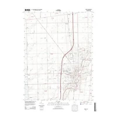
2013 Map of Sidney
USGS Topo · Published 2013About this map
The Sidney municipal area and its surrounding Shelby County townships are defined by the winding path of the Great Miami River and an extensive network of drainage ditches and creeks. This 2013 survey illustrates the dense residential layout of neighborhoods like Buckeye Terrace and the civic infrastructure at the Shelby County Fairgrounds. The map provides significant genealogical value through its detailed recording of rural burial grounds, including the Old Saint James Cem in the north and the Brookside Cem near Hardin to the west.
Find a feature on this map
95 named features on this map. Tap any name to fly to it.
Don’t see what you’re looking for? This feature index may not catch every label — zoom into the map to look around manually.
Map Details
Editions of this 2013 Sidney Map
This is the sole edition of this map. No revisions or reprints were ever made.
Other maps of this area

1909 · Loramie
USGS Topo · 1:62,500

1911 · Loramie
USGS Topo · 1:62,500

1911 · Covington
USGS Topo · 1:62,500

1913 · Sidney
USGS Topo · 1:62,500

1914 · Troy
USGS Topo · 1:62,500

1944 · Covington
USGS Topo · 1:62,500

1944 · Sidney
USGS Topo · 1:62,500

1944 · Loramie
USGS Topo · 1:62,500

1944 · Troy
USGS Topo · 1:62,500

1953 · Muncie
USGS Topo · 1:250,000