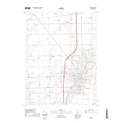
2019 Map of Sidney
USGS Topo · Published 2019About this map
Sidney and its surrounding Shelby County townships are meticulously documented in this contemporary survey, centering on the Shelby County Courthouse and the city's residential expansion. The landscape is defined by the winding course of Turtle Creek and its various tributaries, including E Turtle Cr and Tilberry Run, which cut through the agricultural sections of the county. A high density of rural burial grounds, such as Old Saint James Cem, Pearl Cem, and McClure Cem, provides a detailed record of local family history and settlement patterns. Beyond the city limits, the map traces the outlying communities of Swanders to the north and Hardin to the west, linked by a grid of county and township roads. The survey also captures industrial and civic landmarks, from the Graceland Cem to the south to the network of ditches like Kiser Ditch used for regional water management.
Find a feature on this map
67 named features on this map. Tap any name to fly to it.
Don’t see what you’re looking for? This feature index may not catch every label — zoom into the map to look around manually.
Map Details
Editions of this 2019 Sidney Map
This is the sole edition of this map. No revisions or reprints were ever made.
Other maps of this area

1909 · Loramie
USGS Topo · 1:62,500

1911 · Loramie
USGS Topo · 1:62,500

1911 · Covington
USGS Topo · 1:62,500

1913 · Sidney
USGS Topo · 1:62,500

1914 · Troy
USGS Topo · 1:62,500

1944 · Covington
USGS Topo · 1:62,500

1944 · Sidney
USGS Topo · 1:62,500

1944 · Loramie
USGS Topo · 1:62,500

1944 · Troy
USGS Topo · 1:62,500

1953 · Muncie
USGS Topo · 1:250,000