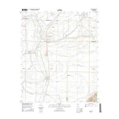
2015 Map of Sidon
USGS Topo · Published 2015About this map
The Yazoo River defines the western edge of this Mississippi Delta landscape, creating a complex network of oxbows and bayous. In the southern portion of the sheet, the settlement of Sidon sits near the river's edge, home to the Mount Pisgah Cem and a grid of rural roads. Northward, the town of Rising Sun is situated between the river and the Pelucia Creek drainage, while the outskirts of Greenwood appear in the north-central area. The map reveals the intricate water management of the Delta through features like the Sidon Cut-Off and the Walker Lake Canal. Local history is preserved in several small cemeteries, including Travel Rest Cem, Ingleside Cem, and the Saint Paul Cem near Roebuck. This agricultural region is punctuated by numerous lakes, from the large Bee Lake in the south to Pleasant Lake and Round Lake in the center.
Find a feature on this map
83 named features on this map. Tap any name to fly to it.
Don’t see what you’re looking for? This feature index may not catch every label — zoom into the map to look around manually.
Map Details
Editions of this 2015 Sidon Map
This is the sole edition of this map. No revisions or reprints were ever made.
Other maps of this area

1931 · Schlater
USGS Topo · 1:48,000

1934 · Schlater
USGS Topo · 1:62,500

1936 · Greenwood
USGS Topo · 1:62,500

1939 · Schlater
USGS Topo · 1:62,500

1940 · Seven Pines
USGS Topo · 1:62,500

1940 · Greenwood
USGS Topo · 1:62,500

1953 · Greenwood
USGS Topo · 1:250,000

1956 · Greenwood
USGS Topo · 1:250,000

1957 · Greenwood
USGS Topo · 1:62,500

1957 · Seven Pines
USGS Topo · 1:62,500