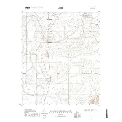
2020 Map of Sidon
USGS Topo · Published 2020About this map
The Yazoo River defines the western reaches of this landscape, its winding course marked by hydrological features such as the Sidon Cut-Off and numerous oxbow formations like Fish Lake and Bee Lake. In the northern portion, the outskirts of Greenwood give way to smaller riverside settlements including Rising Sun and Roebuck. This 2020 survey documents a transition from the structured street grids of the county seat to the sprawling wetlands and agricultural tracts characteristic of the Delta. Local history is anchored in the numerous burial grounds and spiritual centers dotting the terrain, from Greenwood Memorial Park to the Mount Pisgah Cem and Saint Paul Cem. The drainage network, including Pelucia Creek and Walker Lake Canal, illustrates the extensive engineering required to manage this water-rich environment between the Leflore and Carroll County line.
Find a feature on this map
88 named features on this map. Tap any name to fly to it.
Don’t see what you’re looking for? This feature index may not catch every label — zoom into the map to look around manually.
Map Details
Editions of this 2020 Sidon Map
This is the sole edition of this map. No revisions or reprints were ever made.
Other maps of this area

1931 · Schlater
USGS Topo · 1:48,000

1934 · Schlater
USGS Topo · 1:62,500

1936 · Greenwood
USGS Topo · 1:62,500

1939 · Schlater
USGS Topo · 1:62,500

1940 · Seven Pines
USGS Topo · 1:62,500

1940 · Greenwood
USGS Topo · 1:62,500

1953 · Greenwood
USGS Topo · 1:250,000

1956 · Greenwood
USGS Topo · 1:250,000

1957 · Greenwood
USGS Topo · 1:62,500

1957 · Seven Pines
USGS Topo · 1:62,500