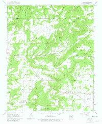
1963 Map of Sidon
USGS Topo · Published 1981About this map
Sidon and Joy anchor this 1963 landscape in White County, where the hills of Mount Pisgah Ridge meet the drainage basins of Bayou des Arc and Hog Thief Creek. The area is defined by its small, scattered settlements and agricultural clearings tucked between steep hollows like Murdough Hollow and Bennett Hollow. Local history and genealogy are preserved in the locations of the Sidon Cem, Pleasant Ridge Cem, and several rural meeting houses including Mt Hebron Ch and Bethel Ch.
Find a feature on this map
47 named features on this map. Tap any name to fly to it.
Don’t see what you’re looking for? This feature index may not catch every label — zoom into the map to look around manually.
Map Details
Editions of this 1963 Sidon Map
2 editions found

Other maps of this area

1953 · Memphis
USGS Topo · 1:250,000

1956 · Memphis
USGS Topo · 1:250,000

1956 · Russellville
USGS Topo · 1:250,000

1962 · Pangburn
USGS Topo · 1:24,000

1962 · Letona
USGS Topo · 1:24,000

1963 · Rose Bud
USGS Topo · 1:24,000

1963 · Garner
USGS Topo · 1:24,000

1963 · Floyd
USGS Topo · 1:24,000

1963 · West Pangburn
USGS Topo · 1:24,000

1963 · Mount Vernon
USGS Topo · 1:24,000