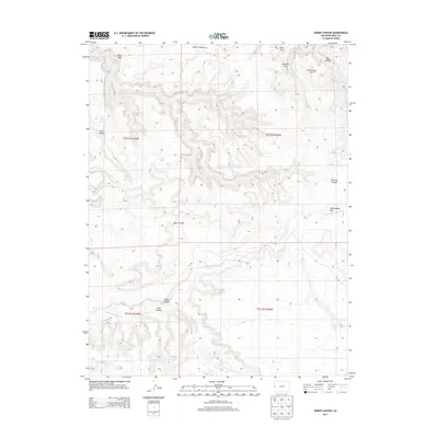
2013 Map of Sieber Canyon
USGS Topo · Published 2013About this map
Arete Arch, Bulwark Arch, and Protractor Arch dominate the northeastern reaches of this landscape, marking a terrain defined by high mesas and deep drainage systems. The Little Dolores River carves through the southern portion of the quadrangle, joined by the complex erosion of Sieber Canyon and Toms Canyon. This 2013 survey illustrates a largely uninhabited and primitive expanse of Mesa County, where human presence is indicated only by remote routes such as A 2/10 Rd and B S Rd. The drainage network, including Twentyeight Hole Wash and Jones Canyon, showcases the intricate watershed patterns typical of the high desert plateau. Prominent landforms like Long Mesa and the aptly named Hells Hole emphasize the verticality and isolation of this region.
Find a feature on this map
20 named features on this map. Tap any name to fly to it.
Don’t see what you’re looking for? This feature index may not catch every label — zoom into the map to look around manually.
Map Details
Editions of this 2013 Sieber Canyon Map
This is the sole edition of this map. No revisions or reprints were ever made.
Other maps of this area

1885 · East Tavaputs
USGS Topo · 1:250,000

1885 · La Sal
USGS Topo · 1:250,000

1954 · Mt. Waas 1 NE
USGS Topo · 1:24,000

1954 · Coates Creek
USGS Topo · 1:62,500

1956 · Westwater 4 SE
USGS Topo · 1:24,000

1956 · Moab
USGS Topo · 1:250,000

1956 · Grand Junction
USGS Topo · 1:250,000

1959 · Grand Junction
USGS Topo · 1:250,000

1959 · Moab
USGS Topo · 1:250,000

1960 · Moab
USGS Topo · 1:250,000