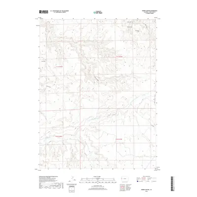
2019 Map of Sieber Canyon
USGS Topo · Published 2019About this map
Little Dolores River flows through the southwestern corner of this Colorado landscape, highlighting a region defined by dramatic vertical relief and natural sandstone features. Natural formations such as Arete Arch, Bulwark Arch, and Protractor Arch are documented in the northern reaches, while the flat-topped profile of Long Mesa dominates the west. The drainage network is particularly well-defined, showing how Sieber Canyon, Knowles Canyon, and Mee Canyon carve into the high desert plateaus. Sparse infrastructure is represented by designated routes like B S RD and A 2/10 RD, which navigate around the deep incisions of Twentyeight Hole Wash. This modern survey provides an exact look at the geological landmarks and remote access points of Mesa County before any further development or shift in land management.
Find a feature on this map
19 named features on this map. Tap any name to fly to it.
Don’t see what you’re looking for? This feature index may not catch every label — zoom into the map to look around manually.
Map Details
Editions of this 2019 Sieber Canyon Map
This is the sole edition of this map. No revisions or reprints were ever made.
Other maps of this area

1885 · East Tavaputs
USGS Topo · 1:250,000

1885 · La Sal
USGS Topo · 1:250,000

1954 · Mt. Waas 1 NE
USGS Topo · 1:24,000

1954 · Coates Creek
USGS Topo · 1:62,500

1956 · Westwater 4 SE
USGS Topo · 1:24,000

1956 · Moab
USGS Topo · 1:250,000

1956 · Grand Junction
USGS Topo · 1:250,000

1959 · Grand Junction
USGS Topo · 1:250,000

1959 · Moab
USGS Topo · 1:250,000

1960 · Moab
USGS Topo · 1:250,000