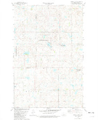
1981 Map of Siebold Lake
USGS Topo · Published 1982About this map
National Waterfowl Production Area land dominates this prairie landscape, where the conservation of wetlands and nesting habitats is the primary use of the terrain. The map captures a section of the North Dakota pothole region characterized by numerous small water bodies and larger basins such as Siebold Lake, England Lake, and Alkali Lake. Spanning the border of McLean and Sheridan counties, the area reflects a transition from early 20th-century agricultural township divisions to federally managed wildlife zones. Surveyed in the late 1970s, the map identifies small-scale industrial sites like a Gravel Pit and established land divisions in Byersville and Holmes, indicating how rural development persists alongside significant environmental protection efforts in the Northern Plains.
Find a feature on this map
8 named features on this map. Tap any name to fly to it.
Don’t see what you’re looking for? This feature index may not catch every label — zoom into the map to look around manually.
Map Details
Editions of this 1981 Siebold Lake Map
This is the sole edition of this map. No revisions or reprints were ever made.
Other maps of this area

1929 · Balfour
USGS Topo · 1:62,500

1930 · Drake
USGS Topo · 1:62,500

1945 · Pelican Lake
USGS Topo · 1:62,500

1947 · Pelican Lake
USGS Topo · 1:62,500

1947 · Lincoln Valley
USGS Topo · 1:62,500

1954 · McClusky
USGS Topo · 1:250,000

1958 · McClusky
USGS Topo · 1:250,000

1958 · Butte
USGS Topo · 1:24,000

1958 · Drake
USGS Topo · 1:62,500

1958 · Balfour
USGS Topo · 1:62,500