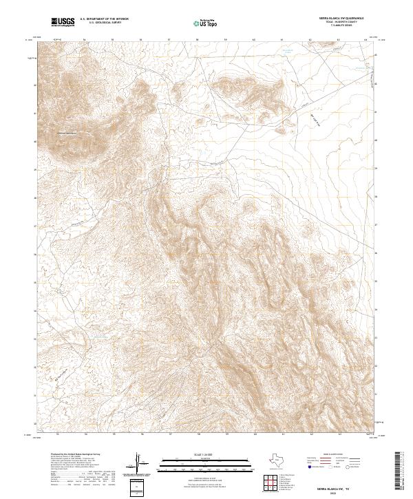
2022 Map of Sierra Blanca SW
USGS Topo · Published 2022About this map
The Quitman Mountains dominate this southwestern Texas landscape, defining a region of dramatic elevation changes and arid drainage patterns. Recorded in the early 21st century, the map illustrates how water management is central to this Chihuahuan Desert environment, noted by essential catchments like Sevenmile Tank, Fivemile Tank, and Davis Pond. These features, along with names like Big Tank Canyon, reflect a history of ranching and survival in a territory where permanent surface water is rare. High-clearance routes such as Quitman Pass Rd and Indian Hot Springs Rd provide the primary access through the steep terrain, while the broad expanse of Red Light Draw indicates the natural alluvial paths that shape the valleys between the peaks.
Find a feature on this map
10 named features on this map. Tap any name to fly to it.
Don’t see what you’re looking for? This feature index may not catch every label — zoom into the map to look around manually.
Map Details
Editions of this 2022 Sierra Blanca SW Map
This is the sole edition of this map. No revisions or reprints were ever made.
Other maps of this area

1894 · Fort Hancock
USGS Topo · 1:125,000

1895 · Sierra Blanca
USGS Topo · 1:125,000

1897 · Eagle Mountain
USGS Topo · 1:125,000

1916 · Eagle Mountain
USGS Topo · 1:125,000

1943 · Fort Quitman
USGS Topo · 1:62,500

1954 · Van Horn
USGS Topo · 1:250,000

1958 · Van Horn
USGS Topo · 1:250,000

1959 · Marfa
USGS Topo · 1:250,000

1964 · Devil Ridge
USGS Topo · 1:24,000

1964 · Lasca
USGS Topo · 1:24,000