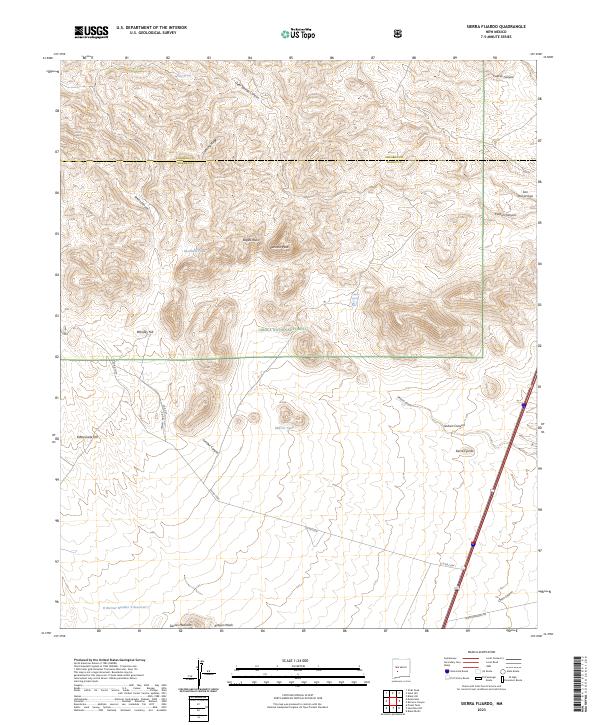
2023 Map of Sierra Fijardo
USGS Topo · Published 2023About this map
The Cibola National Forest encompasses a dramatic high-desert landscape across the border of Socorro and Sierra Counties. Central to this terrain is Peñasco Peak, which stands as a prominent landmark overlooking the deep cuts of Peñasco Canyon and Lumber Canyon. The area is defined by its water management features in an arid environment, including livestock or wildlife watering points like Ducknest Tank and Marcus Tank. To the south, the H Bierner Number 2 Reservoir and Aragon Wash manage seasonal runoff. The namesake Sierra Fijardo rise dominates the southeastern portion of the quadrangle, while the presence of Co RD c034 and Pankey Hdq Rd indicates the sparse but vital road network supporting the region's ranching and national forest access. This landscape reflects the rugged character of New Mexico's mountainous interior, where named points like Whiskey Hill and Rattlesnake Hill suggest a history of local navigation and land use.
Find a feature on this map
33 named features on this map. Tap any name to fly to it.
Don’t see what you’re looking for? This feature index may not catch every label — zoom into the map to look around manually.
Map Details
Editions of this 2023 Sierra Fijardo Map
This is the sole edition of this map. No revisions or reprints were ever made.
Other maps of this area

1954 · Tularosa
USGS Topo · 1:250,000

1958 · Tularosa
USGS Topo · 1:250,000

1961 · Priest Tank
USGS Topo · 1:24,000

1961 · Huerfano Hill
USGS Topo · 1:24,000

1961 · Sierra Fijardo
USGS Topo · 1:24,000

1961 · Black Bluffs
USGS Topo · 1:24,000

1961 · Black Hill
USGS Topo · 1:24,000

1961 · Monticello
USGS Topo · 1:24,000

1961 · Romero Canyon
USGS Topo · 1:24,000

1964 · Vicks Peak
USGS Topo · 1:24,000