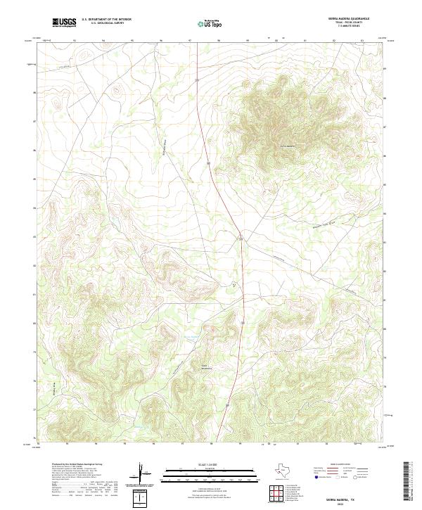
2022 Map of Sierra Madera
USGS Topo · Published 2022About this map
Sierra Madera dominates this West Texas landscape, marking a prominent geological structure within the Pecos County desert. To the southwest, the northern reaches of the Glass Mountains rise near Montgomery Hill Rd, showcasing the region's complex topography. The map illustrates a sparse but vital water management system necessary for ranching and land use in this arid environment, featuring localized catchments like Home Pasture Tank and Huelem Tank. Drainage patterns are defined by dry washes such as Sixshooter Draw, Number Four Draw, and Belding Draw, which carve through the high desert floor. Transportation is limited to a few secondary routes, including Esca Lera Rd and Longfellow Rd, which branch off the primary corridor of Route 385.
Find a feature on this map
11 named features on this map. Tap any name to fly to it.
Don’t see what you’re looking for? This feature index may not catch every label — zoom into the map to look around manually.
Map Details
Editions of this 2022 Sierra Madera Map
This is the sole edition of this map. No revisions or reprints were ever made.
Other maps of this area

1920 · Longfellow
USGS Topo · 1:125,000

1923 · Hess Canyon
USGS Topo · 1:62,500

1923 · Sierra Madera
USGS Topo · 1:62,500

1928 · Comanche Spring
USGS Topo · 1:125,000

1929 · Hovey
USGS Topo · 1:125,000

1954 · Fort Stockton
USGS Topo · 1:250,000

1958 · Fort Stockton
USGS Topo · 1:250,000

1968 · Marathon Gap
USGS Topo · 1:24,000
1968 · Reininger Draw
USGS Topo · 1:24,000

1973 · Fort Stockton
USGS Topo · 1:250,000