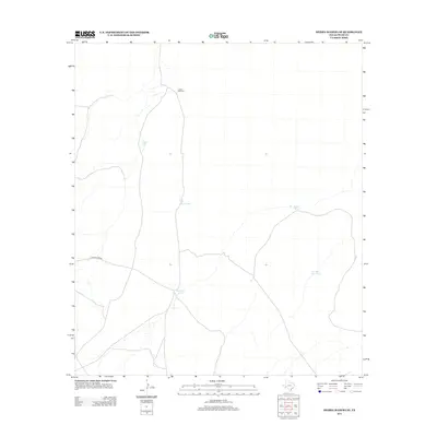
2012 Map of Sierra Madera SE
USGS Topo · Published 2012About this map
Longfellow Rd cuts across the arid landscape of Pecos County, serving as the primary corridor through this ranching territory. The distribution of water sources across the terrain reveals the necessity of managed resources in this part of West Texas, where life and livestock revolve around scattered improvements. Named infrastructure like the Lemon Windmill and Lemon Tank indicate family or landholding names associated with the region's agricultural history. Other features, including Tally Taylor Tank, Bill Taylor Tank, and Mitchell Tank, further map the network of private reservoirs and watering holes that define the rural economy. In the southeastern corner, the presence of the Number Nine Tank suggests a numbered system of land management, documenting the functional landscape of modern Pecos County ranching operations.
Find a feature on this map
7 named features on this map. Tap any name to fly to it.
Don’t see what you’re looking for? This feature index may not catch every label — zoom into the map to look around manually.
Map Details
Editions of this 2012 Sierra Madera SE Map
This is the sole edition of this map. No revisions or reprints were ever made.
Other maps of this area

1920 · Longfellow
USGS Topo · 1:125,000

1923 · Sierra Madera
USGS Topo · 1:62,500

1928 · Comanche Spring
USGS Topo · 1:125,000

1954 · Fort Stockton
USGS Topo · 1:250,000

1958 · Fort Stockton
USGS Topo · 1:250,000

1968 · Marathon Gap
USGS Topo · 1:24,000

1968 · Ebers Camp
USGS Topo · 1:24,000
1968 · Reininger Draw
USGS Topo · 1:24,000

1973 · Fort Stockton
USGS Topo · 1:250,000
1980 · Sierra Madera SE
USGS Topo · 1:24,000