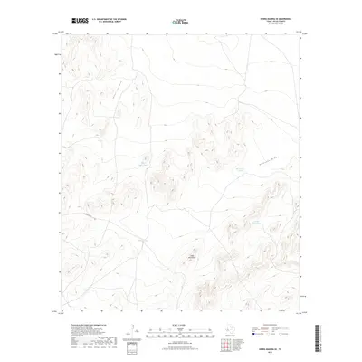
2019 Map of Sierra Madera SE
USGS Topo · Published 2019About this map
The Glass Mountains rise across this high-desert landscape of Pecos County, characterized by a complex network of drainage draws and livestock watering points. This 2019 survey documents the essential water infrastructure required for ranching in such an arid environment, where named tanks such as Mitchell Tank and Lemon Tank serve as critical landmarks. The presence of Tally Taylor Tank and Bill Taylor Tank reflects a history of family-managed land use and tenure in this portion of West Texas. Transport through the area is defined by Longfellow Rd, which traverses the southern elevations. The map provides a clear picture of the modern drainage patterns through Nineteen Draw and Number Four Draw, illustrating how the geography of the Glass Mountains dictates the flow of water and the placement of human improvements.
Find a feature on this map
9 named features on this map. Tap any name to fly to it.
Don’t see what you’re looking for? This feature index may not catch every label — zoom into the map to look around manually.
Map Details
Editions of this 2019 Sierra Madera SE Map
This is the sole edition of this map. No revisions or reprints were ever made.
Other maps of this area

1920 · Longfellow
USGS Topo · 1:125,000

1923 · Sierra Madera
USGS Topo · 1:62,500

1928 · Comanche Spring
USGS Topo · 1:125,000

1954 · Fort Stockton
USGS Topo · 1:250,000

1958 · Fort Stockton
USGS Topo · 1:250,000

1968 · Marathon Gap
USGS Topo · 1:24,000

1968 · Ebers Camp
USGS Topo · 1:24,000
1968 · Reininger Draw
USGS Topo · 1:24,000

1973 · Fort Stockton
USGS Topo · 1:250,000
1980 · Sierra Madera SE
USGS Topo · 1:24,000