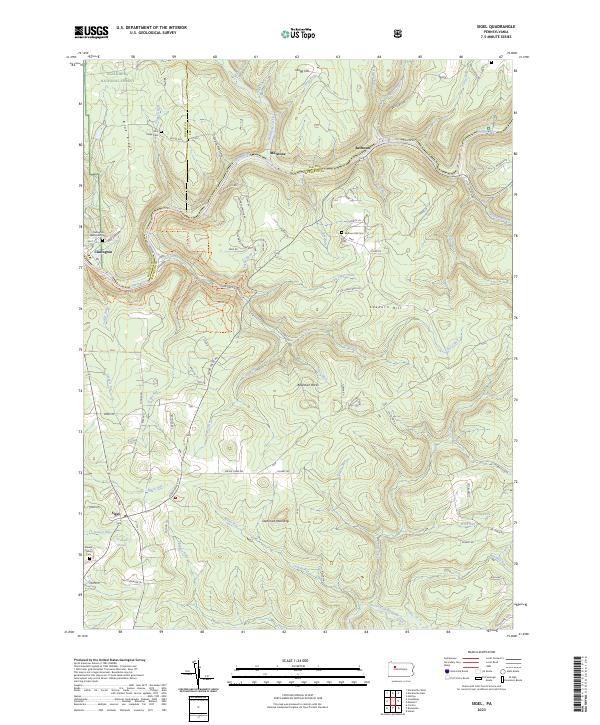
2023 Map of Sigel
USGS Topo · Published 2023About this map
The Clarion River winds through the northern portion of this landscape, marking the boundary between the Allegheny National Forest and the northern reaches of Jefferson County. Small settlements and rural crossroads like Clarington, Millstone, and Belltown follow the river's path, while the village of Sigel anchors the southwestern corner. The terrain is defined by a dense network of high-elevation points and deep drainages, including Gregg Hill, Edeburn Hill, and the notable formation of Beartown Rocks. For local historians and genealogists, the map preserves the locations of several burial grounds, including the Clarington Methodist Cem and Mount Tabor Cem. The southern half of the quadrangle is drained by numerous runs, such as Tarkiln Run and Miller Run, which feed into the North Fork Redbank Creek at the sheet's southern edge.
Find a feature on this map
85 named features on this map. Tap any name to fly to it.
Don’t see what you’re looking for? This feature index may not catch every label — zoom into the map to look around manually.
Map Details
Editions of this 2023 Sigel Map
This is the sole edition of this map. No revisions or reprints were ever made.
Other maps of this area

1918 · Loleta
USGS Topo · 1:62,500

1922 · Du Bois
USGS Topo · 1:62,500

1924 · Du Bois
USGS Topo · 1:62,500

1924 · Brookville
USGS Topo · 1:62,500

1926 · Brookville
USGS Topo · 1:62,500

1936 · Marienville
USGS Topo · 1:48,000

1940 · Hallton
USGS Topo · 1:48,000

1941 · Marienville
USGS Topo · 1:62,500

1943 · Hallton
USGS Topo · 1:62,500

1944 · Du Bois
USGS Topo · 1:62,500