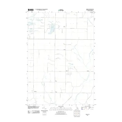
2011 Map of Sigma
USGS Topo · Published 2011About this map
The North Branch Boardman River and North Branch Manistee River define the hydraulic character of this Kalkaska County landscape, marking a significant drainage divide where waters begin their separate journeys toward Lake Michigan. Small clusters of rural habitation like Sigma and Cotton are joined by the smaller settlements of O'Neil, Angling, and Spencer, reflecting a persistent pattern of forest-edge residency.
Find a feature on this map
64 named features on this map. Tap any name to fly to it.
Don’t see what you’re looking for? This feature index may not catch every label — zoom into the map to look around manually.
Map Details
Editions of this 2011 Sigma Map
This is the sole edition of this map. No revisions or reprints were ever made.
Other maps of this area

1949 · Black Creek
USGS Topo · 1:24,000

1949 · Fletcher
USGS Topo · 1:62,500

1950 · Fletcher
USGS Topo · 1:24,000

1954 · Traverse City
USGS Topo · 1:250,000

1956 · Alba
USGS Topo · 1:62,500

1956 · Mancelona
USGS Topo · 1:62,500

1956 · Kalkaska
USGS Topo · 1:62,500

1958 · Traverse City
USGS Topo · 1:250,000

1983 · Traverse City
USGS Topo · 1:100,000
1983 · Grayling
USGS Topo · 1:100,000