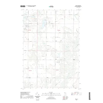
2019 Map of Sigma
USGS Topo · Published 2019About this map
Sigma and Cotton anchor this northern Michigan landscape, where the headwaters of two major river systems begin their descent. The N Br Boardman River flows from the northwest corner while the N Br Manistee River emerges in the northeast, defining a high glacial plateau characterized by extensive wetlands and isolated lakes. Notable water bodies such as Lake Placid and Crawford Lake sit amongst a mosaic of named bogs including Carlisle Swamp and Riley Swamp. This 2019 survey documents the transition between small settlements like Angling and Spencer and the dense forest tracks crossed by the Shore to Shore Trail. Genealogists will find the Excelsior Cem and Oliver Cem clearly marked, serving as enduring landmarks for the rural families of Oliver Township and surrounding Kalkaska County.
Find a feature on this map
95 named features on this map. Tap any name to fly to it.
Don’t see what you’re looking for? This feature index may not catch every label — zoom into the map to look around manually.
Map Details
Editions of this 2019 Sigma Map
This is the sole edition of this map. No revisions or reprints were ever made.
Other maps of this area

1949 · Black Creek
USGS Topo · 1:24,000

1949 · Fletcher
USGS Topo · 1:62,500

1950 · Fletcher
USGS Topo · 1:24,000

1954 · Traverse City
USGS Topo · 1:250,000

1956 · Alba
USGS Topo · 1:62,500

1956 · Mancelona
USGS Topo · 1:62,500

1956 · Kalkaska
USGS Topo · 1:62,500

1958 · Traverse City
USGS Topo · 1:250,000

1983 · Traverse City
USGS Topo · 1:100,000
1983 · Grayling
USGS Topo · 1:100,000