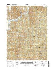
2014 Map of Signal Buttes
USGS Topo · Published 2014About this map
The Rogue River flows through the northern reaches of this coastal Oregon territory, where the historic Bagnell Ferry provided passage between its banks. The landscape is defined by its verticality, rising from river bars like Coyote Bar and Kimball Bar toward the prominent peaks of Signal Buttes and Grizzly Mtn. The eastern portion of the quadrangle is dominated by the Siskiyou National Forest, showing a network of logging and access roads such as Nat For Dev Rd 100.
Find a feature on this map
50 named features on this map. Tap any name to fly to it.
Don’t see what you’re looking for? This feature index may not catch every label — zoom into the map to look around manually.
Map Details
Editions of this 2014 Signal Buttes Map
This is the sole edition of this map. No revisions or reprints were ever made.
Other maps of this area

1899 · Port Orford
USGS Topo · 1:125,000

1903 · Port Orford
USGS Topo · 1:125,000

1954 · Coos Bay
USGS Topo · 1:250,000

1954 · Port Orford
USGS Topo · 1:62,500

1954 · Gold Beach
USGS Topo · 1:62,500

1954 · Collier Butte
USGS Topo · 1:62,500

1954 · Agness
USGS Topo · 1:62,500

1958 · Coos Bay
USGS Topo · 1:250,000

1962 · Coos Bay
USGS Topo · 1:250,000
1986 · Ophir
USGS Topo · 1:24,000