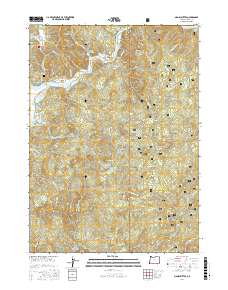
2017 Map of Signal Buttes
USGS Topo · Published 2017About this map
The Rogue River carves through the northern reaches of this coastal Oregon landscape, defining a series of bars and riffles that once anchored local activity. These riverfront sites, including Kimball Bar, Orchard Bar, and Coyote Bar, alongside the Gillespie Riffle, illustrate the river's historical importance for navigation and settlement in Curry County. Moving away from the water, the terrain rises sharply into the Siskiyou National Forest, where landmarks like Signal Buttes and Grizzly Mtn dominate the skyline. For genealogists and local historians, the presence of the Merriam Cem and Rumley Hill Cem provides critical points of reference for families tied to Rumley Hill and Squaw Valley. The map also captures specialized ecological features such as the Hunter Creek Bog and the Lake of the Woods, tucked into the high country near the headwaters of Hunter Cr.
Find a feature on this map
69 named features on this map. Tap any name to fly to it.
Don’t see what you’re looking for? This feature index may not catch every label — zoom into the map to look around manually.
Map Details
Editions of this 2017 Signal Buttes Map
This is the sole edition of this map. No revisions or reprints were ever made.
Other maps of this area

1899 · Port Orford
USGS Topo · 1:125,000

1903 · Port Orford
USGS Topo · 1:125,000

1954 · Coos Bay
USGS Topo · 1:250,000

1954 · Port Orford
USGS Topo · 1:62,500

1954 · Gold Beach
USGS Topo · 1:62,500

1954 · Collier Butte
USGS Topo · 1:62,500

1954 · Agness
USGS Topo · 1:62,500

1958 · Coos Bay
USGS Topo · 1:250,000

1962 · Coos Bay
USGS Topo · 1:250,000
1986 · Ophir
USGS Topo · 1:24,000