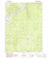
1986 Map of Signal Buttes
USGS Topo · Published 1986About this map
The Rogue River corridor in Curry County defines this 1986 survey, showcasing a landscape of gravel bars and named riffles that speak to the river's historical navigational and recreational importance. Features like Canfield Riffle, Wakeman Riffle, and Orchard Bar indicate a meticulously mapped waterway within the Rogue River National Wild and Scenic River corridor. Near Jerrys Flat, the presence of a Cem and multiple trailer parks suggests a concentrated area of local settlement amidst the larger wilderness.
Find a feature on this map
46 named features on this map. Tap any name to fly to it.
Don’t see what you’re looking for? This feature index may not catch every label — zoom into the map to look around manually.
Map Details
Editions of this 1986 Signal Buttes Map
This is the sole edition of this map. No revisions or reprints were ever made.
Other maps of this area

1899 · Port Orford
USGS Topo · 1:125,000

1903 · Port Orford
USGS Topo · 1:125,000

1954 · Coos Bay
USGS Topo · 1:250,000

1954 · Port Orford
USGS Topo · 1:62,500

1954 · Gold Beach
USGS Topo · 1:62,500

1954 · Collier Butte
USGS Topo · 1:62,500

1954 · Agness
USGS Topo · 1:62,500

1958 · Coos Bay
USGS Topo · 1:250,000

1962 · Coos Bay
USGS Topo · 1:250,000
1986 · Ophir
USGS Topo · 1:24,000