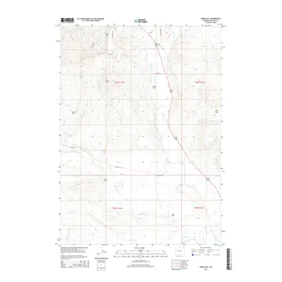
2015 Map of Signal Hill
USGS Topo · Published 2015About this map
Signal Hill and the East Rim define the high terrain of this Sublette County landscape, where numerous seasonal watercourses carve deep through the plateau. A complex network of drainage systems, including Pixley Cr, Crooked Cr, and Culbertson Cr, flows southward toward the Green River, which just clips the southeastern corner of the survey area. These natural corridors are mirrored by a sparse but deliberate road network, including the historic trace of Old Hwy 187 and N Beaver Rd, which follow the contours of the land to connect remote ranching and grazing tracts. Named features like Annie Draw and Watson Draw highlight the localized topography that has long influenced movement and land use in this part of Wyoming. The transition from the high ridges of Aspen Ridge to the low basins of Cow Gulch and Hay Gulch illustrates a high-desert environment shaped by water and wind.
Find a feature on this map
28 named features on this map. Tap any name to fly to it.
Don’t see what you’re looking for? This feature index may not catch every label — zoom into the map to look around manually.
Map Details
Editions of this 2015 Signal Hill Map
This is the sole edition of this map. No revisions or reprints were ever made.
Other maps of this area

1907 · Gros Ventre
USGS Topo · 1:125,000

1910 · Gros Ventre
USGS Topo · 1:125,000

1939 · Big Piney
USGS Topo · 1:125,000

1942 · Big Piney
USGS Topo · 1:125,000

1955 · Driggs
USGS Topo · 1:250,000

1955 · Preston
USGS Topo · 1:250,000

1958 · Driggs
USGS Topo · 1:250,000

1958 · Preston
USGS Topo · 1:250,000

1962 · Driggs
USGS Topo · 1:250,000

1962 · Preston
USGS Topo · 1:250,000