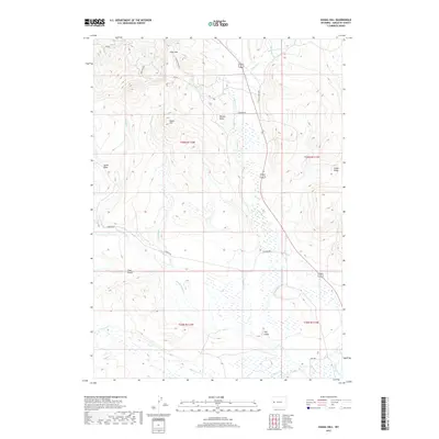
2017 Map of Signal Hill
USGS Topo · Published 2017About this map
Signal Hill rises as a prominent landmark in this portion of Sublette County, anchoring a landscape defined by the drainage systems of the Upper Green River basin. The area is marked by a network of seasonal and perennial waterways, including N Beaver Cr, Middle Beaver Cr, and S Beaver Cr, which carve through the high-elevation terrain. These watercourses are flanked by significant topographic features such as the East Rim and Aspen Ridge, while smaller landforms like Cow Gulch and Hay Gulch indicate the complex erosion patterns of the region.
Find a feature on this map
27 named features on this map. Tap any name to fly to it.
Don’t see what you’re looking for? This feature index may not catch every label — zoom into the map to look around manually.
Map Details
Editions of this 2017 Signal Hill Map
This is the sole edition of this map. No revisions or reprints were ever made.
Other maps of this area

1907 · Gros Ventre
USGS Topo · 1:125,000

1910 · Gros Ventre
USGS Topo · 1:125,000

1939 · Big Piney
USGS Topo · 1:125,000

1942 · Big Piney
USGS Topo · 1:125,000

1955 · Driggs
USGS Topo · 1:250,000

1955 · Preston
USGS Topo · 1:250,000

1958 · Driggs
USGS Topo · 1:250,000

1958 · Preston
USGS Topo · 1:250,000

1962 · Driggs
USGS Topo · 1:250,000

1962 · Preston
USGS Topo · 1:250,000