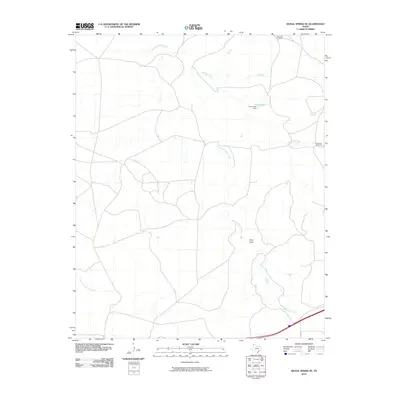
2010 Map of Signal Spring SE
USGS Topo · Published 2010About this map
Agua de Piedra Creek dominates this high plains landscape in the Texas Panhandle, carving a winding path through the open terrain of Oldham County. The 2010 survey illustrates a sparsely populated ranching environment where water management is central to the land's utility. Significant man-made improvements include the Curry Lake Dam creating Curry Lake, a vital reservoir in this arid region. The presence of the Deep Well Windmill and Red Gate Windmill further underscores the reliance on groundwater and mechanical pumping to support livestock and habitation. Transportation is limited to a few primary arteries like FM 2858, while several smaller drainages such as Lost Mule Creek and East Fork Mujares Creek define the local topography alongside the notable landmark of Paint Rock.
Find a feature on this map
9 named features on this map. Tap any name to fly to it.
Don’t see what you’re looking for? This feature index may not catch every label — zoom into the map to look around manually.
Map Details
Editions of this 2010 Signal Spring SE Map
This is the sole edition of this map. No revisions or reprints were ever made.
Other maps of this area

1954 · Tucumcari
USGS Topo · 1:250,000

1958 · Tucumcari
USGS Topo · 1:250,000

1966 · Moser Ranch
USGS Topo · 1:24,000

1966 · Signal Spring
USGS Topo · 1:24,000

1966 · Boise
USGS Topo · 1:24,000

1966 · Simms NW
USGS Topo · 1:24,000

1966 · Adrian
USGS Topo · 1:24,000

1966 · Signal Spring SE
USGS Topo · 1:24,000

1966 · Big George Tank
USGS Topo · 1:24,000

1966 · Vat Camp
USGS Topo · 1:24,000