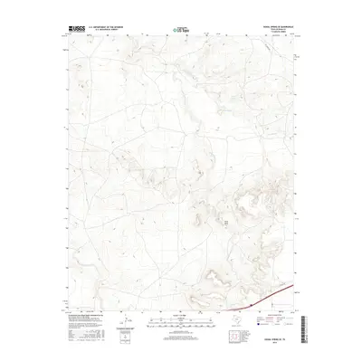
2016 Map of Signal Spring SE
USGS Topo · Published 2016About this map
Agua de Piedra Cr snakes through this arid Panhandle landscape, cutting deep drainages into the high plains of Oldham County. The terrain is defined by its watercourses, including Lost Mule Cr and the waters of Curry Lake, which serve as critical landmarks in an area dominated by large ranch holdings. The prominence of Paint Rock stands as a distinct topographical marker amid the winding draws and ridges. Transport across this sparsely populated region relies on a network of rural routes such as FM 2858 and the appropriately named Pvt Ranch Rd, reflecting the private-land heritage of the Texas cattle country. Modern infrastructure like the L 40 Svc Rd follows the southern edge, contrasting the newer transport corridors with the natural flow of E Fork Mujeres Cr.
Find a feature on this map
8 named features on this map. Tap any name to fly to it.
Don’t see what you’re looking for? This feature index may not catch every label — zoom into the map to look around manually.
Map Details
Editions of this 2016 Signal Spring SE Map
This is the sole edition of this map. No revisions or reprints were ever made.
Other maps of this area

1954 · Tucumcari
USGS Topo · 1:250,000

1958 · Tucumcari
USGS Topo · 1:250,000

1966 · Moser Ranch
USGS Topo · 1:24,000

1966 · Signal Spring
USGS Topo · 1:24,000

1966 · Boise
USGS Topo · 1:24,000

1966 · Simms NW
USGS Topo · 1:24,000

1966 · Adrian
USGS Topo · 1:24,000

1966 · Signal Spring SE
USGS Topo · 1:24,000

1966 · Big George Tank
USGS Topo · 1:24,000

1966 · Vat Camp
USGS Topo · 1:24,000