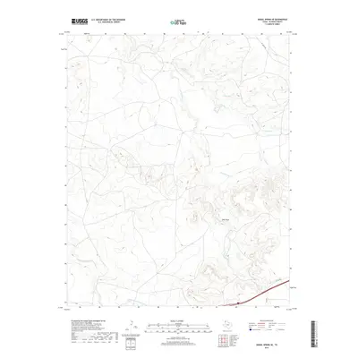
2019 Map of Signal Spring SE
USGS Topo · Published 2019About this map
Paint Rock stands as a prominent landmark in this segment of Oldham County, where the landscape is defined by the branching drainage systems of the Canadian River basin. In the late 2010s, the terrain is etched by the meandering courses of Lost Mule Cr and Agua de Piedra Cr, which cut through the high plains toward the north. These ephemeral waterways, along with the E Fork Mujares Cr and its associated E Strip E Fork Mujares Cr, illustrate the complex erosion patterns characteristic of the Texas Panhandle. Modern infrastructure, including the I-40 Svc Rd and FM 2858, skirts the southern boundary, providing access to remote ranching interior via the Pvt Ranch Rd. The presence of Curry Lake highlights the scarcity and importance of surface water in this arid ranching environment.
Find a feature on this map
9 named features on this map. Tap any name to fly to it.
Don’t see what you’re looking for? This feature index may not catch every label — zoom into the map to look around manually.
Map Details
Editions of this 2019 Signal Spring SE Map
This is the sole edition of this map. No revisions or reprints were ever made.
Other maps of this area

1954 · Tucumcari
USGS Topo · 1:250,000

1958 · Tucumcari
USGS Topo · 1:250,000

1966 · Moser Ranch
USGS Topo · 1:24,000

1966 · Signal Spring
USGS Topo · 1:24,000

1966 · Boise
USGS Topo · 1:24,000

1966 · Simms NW
USGS Topo · 1:24,000

1966 · Adrian
USGS Topo · 1:24,000

1966 · Signal Spring SE
USGS Topo · 1:24,000

1966 · Big George Tank
USGS Topo · 1:24,000

1966 · Vat Camp
USGS Topo · 1:24,000