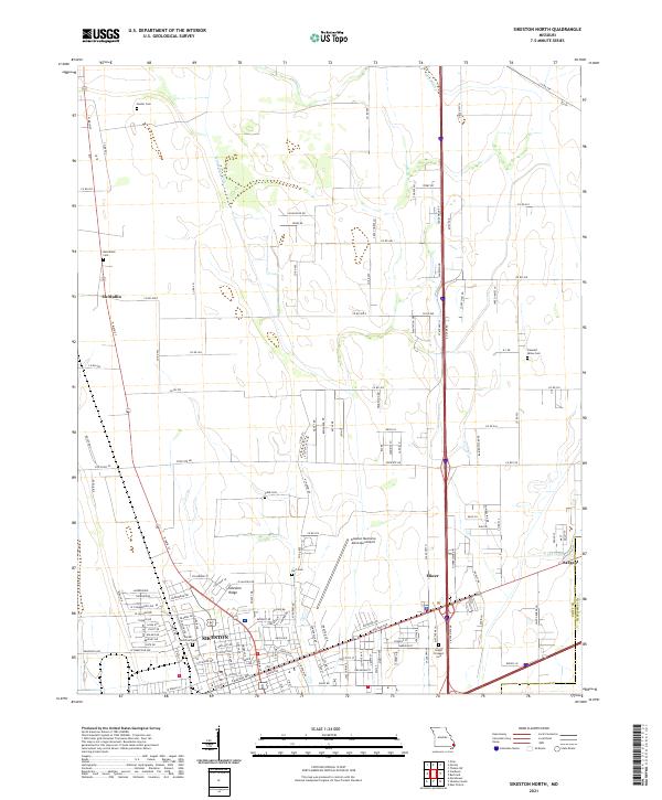
2021 Map of Sikeston North
USGS Topo · Published 2021About this map
Sikeston and the surrounding farmland of Scott County are defined by an extensive network of drainage channels, including Saint Johns Ditch and Town Ditch. These man-made waterways underscore the region's agricultural history, transforming the low-lying terrain into productive acreage. The map details the northern expansion of the city, showing the intersection of major transit corridors near Miner and the residential reach along Sikeston Ridge.
Find a feature on this map
148 named features on this map. Tap any name to fly to it.
Don’t see what you’re looking for? This feature index may not catch every label — zoom into the map to look around manually.
Map Details
Editions of this 2021 Sikeston North Map
This is the sole edition of this map. No revisions or reprints were ever made.
Other maps of this area

1931 · Sikeston
USGS Topo · 1:62,500

1934 · Thebes
USGS Topo · 1:62,500

1934 · Morley
USGS Topo · 1:62,500

1934 · Sikeston
USGS Topo · 1:62,500

1939 · Sikeston
USGS Topo · 1:62,500

1939 · Charleston
USGS Topo · 1:62,500

1939 · Morley
USGS Topo · 1:62,500

1939 · Thebes
USGS Topo · 1:62,500

1949 · Paducah
USGS Topo · 1:250,000

1950 · Paducah
USGS Topo · 1:250,000