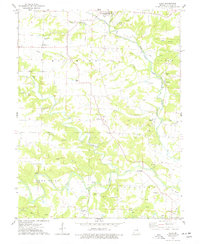
1975 Map of Silex
USGS Topo · Published 1977About this map
Silex and the surrounding agricultural townships of Millwood, Union, Hawk Point, and Bedford define this mid-1970s landscape in Lincoln County. The area is heavily marked by the drainage patterns of the North Fork Cuivre River and the West Fork Cuivre River, which converge amidst a network of smaller tributaries like Lead Creek and Sitton Branch. This period shows a rural community deeply connected to its land and ancestry, evidenced by the high density of family and church cemeteries including Sitton Cem, St Alphonsus Cem, and Sulphur Lick Cem.
Find a feature on this map
47 named features on this map. Tap any name to fly to it.
Don’t see what you’re looking for? This feature index may not catch every label — zoom into the map to look around manually.
Map Details
Editions of this 1975 Silex Map
2 editions found
Other maps of this area

1890 · Louisiana
USGS Topo · 1:125,000

1890 · Hermann
USGS Topo · 1:125,000

1903 · O'Fallon
USGS Topo · 1:125,000

1934 · Elsberry
USGS Topo · 1:48,000

1937 · Silex
USGS Topo · 1:62,500

1939 · Silex
USGS Topo · 1:48,000

1941 · Troy
USGS Topo · 1:62,500

1942 · Elsberry
USGS Topo · 1:62,500

1943 · Warrenton
USGS Topo · 1:62,500

1945 · Troy
USGS Topo · 1:62,500