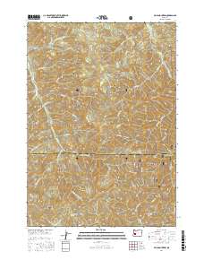
2017 Map of Silica Mountain
USGS Topo · Published 2017About this map
The Calapooya Divide marks the high-elevation boundary between Lane and Douglas Counties, anchoring a landscape of dense drainage networks and sharp ridges. This section of the Umpqua National Forest is defined by the headwaters of several significant waterways, including Mosby Cr and its numerous forks, which flow northward toward the Row River. To the east, the terrain drops toward Sharps Cr and Walker Cr, areas long associated with Oregon's mining history. The map highlights the complex forest road system essential for managing these timberlands, such as Mosby Creek Rd and various Bureau of Land Management routes. Notable peaks like Silica Mountain, Holderman Mtn, and Snow Peak provide topographic context for the many springs and small tributaries, including Huckleberry Spring and Norwegian Cr, that feed the larger creek basins.
Find a feature on this map
60 named features on this map. Tap any name to fly to it.
Don’t see what you’re looking for? This feature index may not catch every label — zoom into the map to look around manually.
Map Details
Editions of this 2017 Silica Mountain Map
This is the sole edition of this map. No revisions or reprints were ever made.
Other maps of this area

1935 · Lowell
USGS Topo · 1:96,000

1942 · Lowell
USGS Topo · 1:125,000

1955 · Mace Mtn
USGS Topo · 1:62,500

1955 · Illahee Rock
USGS Topo · 1:62,500

1955 · Fairview Peak
USGS Topo · 1:62,500

1955 · Culp Creek
USGS Topo · 1:62,500

1958 · Roseburg
USGS Topo · 1:250,000

1959 · Roseburg
USGS Topo · 1:250,000

1978 · Diamond Lake
USGS Topo · 1:100,000

1983 · Oakridge
USGS Topo · 1:100,000