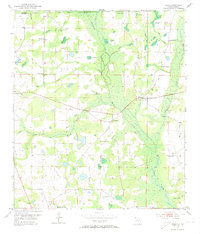
1952 Map of Sills
USGS Topo · Published 1973About this map
Chipola River and its intricate network of wetland features define the borderlands where the Alabama-Florida state line meets the Houston and Jackson County boundary. The landscape is dotted with numerous cypress-rich depressions and backwaters, including Moulten Slough, Pine Log Pond, and Sand Bar Pond. This mid-century survey records a rural community infrastructure built around small local centers, such as Sills and the historic Waddells Mill Pond area.
Find a feature on this map
33 named features on this map. Tap any name to fly to it.
Don’t see what you’re looking for? This feature index may not catch every label — zoom into the map to look around manually.
Map Details
Editions of this 1952 Sills Map
2 editions found
Other maps of this area

1952 · Cottondale East
USGS Topo · 1:24,000

1952 · Malone
USGS Topo · 1:24,000

1952 · Campbellton
USGS Topo · 1:24,000

1952 · Cottondale West
USGS Topo · 1:24,000

1952 · Sills
USGS Topo · 1:24,000

1952 · Marianna
USGS Topo · 1:24,000

1953 · Dothan
USGS Topo · 1:250,000

1954 · Dothan
USGS Topo · 1:250,000

1954 · Tallahassee
USGS Topo · 1:250,000

1955 · Dothan
USGS Topo · 1:250,000