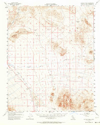
1956 Map of Silurian Hills
USGS Topo · Published 1964About this map
Sperry (Site) and Dumont (Site) represent the fading footprints of desert history on this 1956 mid-century survey of the San Bernardino Mojave. The landscape is defined by the remnants of transit and resource extraction, notably the Old Railroad Grade that winds through the Dumont Hills and past the Dumont Sand Dunes. This rail corridor was essential for servicing the scattered mining sites and remote water stops like Valjean (Site) and Riggs (Site). The hydrography of the region is centered on the ephemeral Silurian Lake and the drainage of Salt Creek and Kingston Wash. These watercourses, along with landmarks like Rabbit Holes Spring, were vital for desert survival and the small-scale mining operations indicated by the Shaft and Tunnel symbols located near the Silurian Hills. This map documents a transitional era when many early 20th-century settlements had already reverted to sites, yet the infrastructure that built them remained visible on the terrain.
Find a feature on this map
21 named features on this map. Tap any name to fly to it.
Don’t see what you’re looking for? This feature index may not catch every label — zoom into the map to look around manually.
Map Details
Editions of this 1956 Silurian Hills Map
3 editions found

Other maps of this area

1910 · Ivanpah
USGS Topo · 1:250,000

1912 · Ivanpah
USGS Topo · 1:250,000

1933 · Avawatz Mountains
USGS Topo · 1:250,000

1942 · Ivanpah
USGS Topo · 1:250,000

1947 · Trona
USGS Topo · 1:250,000

1947 · Kingman
USGS Topo · 1:250,000

1948 · Kingman
USGS Topo · 1:250,000

1948 · Red Pass Lake
USGS Topo · 1:62,500

1948 · Trona
USGS Topo · 1:250,000

1948 · Avawatz Pass
USGS Topo · 1:62,500