
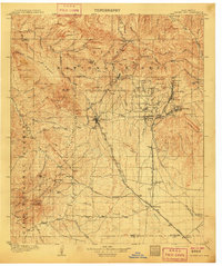
1962 Map of Silver City
USGS Topo · Published 1962About this map
Silver City and the high desert of the Arizona-New Mexico borderland reveal a mid-century landscape dominated by copper extraction and rail transport. The industrial footprint is evident at the Chino Mine and Banner Mining Company, while the Tyrone Mine stands as a silent marker of earlier ventures. This era shows the established connectivity provided by the Southern Pacific and Atchison Topeka and Santa Fe railroads, which linked the agricultural centers of Safford and Willcox to the broader mining district. From the desert expanse of the Willcox Playa to the timbered heights of the Gila National Forest, the map captures a transition point where rugged terrain meets a complex network of federal lands and county divisions. These include the Fort Huachuca Military Reservation and the shared boundaries of Grant and Hidalgo counties.
Find a feature on this map
58 named features on this map. Tap any name to fly to it.
Don’t see what you’re looking for? This feature index may not catch every label — zoom into the map to look around manually.
Map Details
Editions of this 1962 Silver City Map
This is the sole edition of this map. No revisions or reprints were ever made.
Other maps of this area
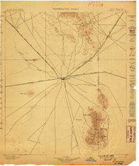
1899 · Deming
USGS Topo · 1:125,000
1902 · Clifton
USGS Topo · 1:62,500
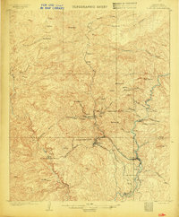
1909 · Silver City
USGS Topo · 1:125,000

1910 · Mogollon
USGS Topo · 1:125,000

1911 · Alum Mountain
USGS Topo · 1:125,000

1912 · Mogollon
USGS Topo · 1:125,000

1913 · Alum Mountain
USGS Topo · 1:125,000

1913 · Morenci
USGS Topo · 1:125,000

1915 · Benson
USGS Topo · 1:125,000

1915 · Morenci
USGS Topo · 1:125,000