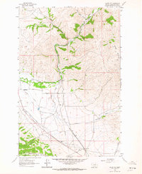
1962 Map of Silver City
USGS Topo · Published 1984About this map
Silver City sits at the southern edge of this Lewis and Clark County landscape, where the Great Northern railroad tracks cut across the high Montana terrain. The 1962 survey reveals a region defined by its water management and ranching history, evidenced by the extensive Justisson Ditch, Vincent Ditch, and Gans Klein Ditch networks that divert flow from Little Prickly Pear Creek and its tributaries. Near the settlement of Chevalier Ranch, the map captures the physical imprint of early resource extraction, including Dredge Tailings along Silver Creek. To the north and west, the elevation rises toward the prominent peak of Baldy Mountain, while the local education of the era is marked at the Canyon Creek Sch. The presence of a Pipeline and multiple jeep trails suggests a landscape transitioning between traditional ranching and modern utility infrastructure.
Find a feature on this map
20 named features on this map. Tap any name to fly to it.
Don’t see what you’re looking for? This feature index may not catch every label — zoom into the map to look around manually.
Map Details
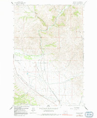
Editions of this 1962 Silver City Map
2 editions found
Other maps of this area

1889 · Helena
USGS Topo · 1:250,000

1893 · Helena
USGS Topo · 1:250,000

1899 · Helena
USGS Topo · 1:62,500

1899 · Helena
USGS Topo · 1:250,000

1903 · Helena
USGS Topo · 1:250,000

1947 · Butte
USGS Topo · 1:250,000

1950 · Helena
USGS Topo · 1:62,500

1958 · Butte
USGS Topo · 1:250,000

1959 · Elliston
USGS Topo · 1:62,500

1960 · Butte
USGS Topo · 1:250,000