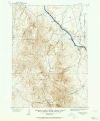
1892 Map of Silver City
USGS Topo · Published 1964About this map
Silver City anchors the high-country mining district of Owyhee County in the late nineteenth century, surrounded by a concentration of significant silver and gold operations. The map details the industrial footprint of the era, including the Black Jack Mine, Trade Dollar Mine, and the Poorman Mine near Florida Mt. To the north, the terrain drops toward the Snake River, where the river-and-road economy relied on crossings like the Warm Springs Ferry and Bernard Ferry. Local settlements such as De Lamar, Dewey, and Murphy provide a look at the early infrastructure supporting the region's mineral wealth. The landscape is defined by its drainage basins, from Sinker Creek in the east to the winding Reynolds Creek that flows through the center of the quadrangle. This 1892 survey preserves the relationship between the remote mountain camps and the essential ferry connections along the river valley.
Find a feature on this map
48 named features on this map. Tap any name to fly to it.
Don’t see what you’re looking for? This feature index may not catch every label — zoom into the map to look around manually.
Map Details
Editions of this 1892 Silver City Map
2 editions found
Other maps of this area

1892 · Boise
USGS Topo · 1:125,000

1892 · Bisuka
USGS Topo · 1:125,000

1892 · Silver City
USGS Topo · 1:125,000

1894 · Bisuka
USGS Topo · 1:125,000

1894 · Silver City
USGS Topo · 1:125,000

1897 · Boise
USGS Topo · 1:125,000

1898 · Nampa
USGS Topo · 1:125,000

1898 · Silver City
USGS Topo · 1:125,000

1906 · Mitchell Butte
USGS Topo · 1:125,000

1948 · Sinker Butte
USGS Topo · 1:24,000