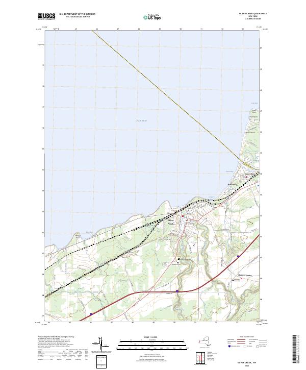
2023 Map of Silver Creek
USGS Topo · Published 2023About this map
Silver Creek serves as the primary hub of this Lake Erie shoreline, where the waters of Walnut Creek and the namesake Silver Creek meet the bay. The map documents a landscape defined by its coastal orientation, from the residential clusters at Hanford Bay and Sunset Bay to the northern reaches of Lotus Point and Millers Beach. Inland, the terrain shifts toward rural agricultural and cemetery sites, including Mount Carmel Cem and Glenwood Cem. The eastern boundary is marked by the winding path of Cattaraugus Creek, which separates Chautauqua and Erie Counties. This modern survey illustrates the enduring relationship between the village center and its lakefront developments, tracing a network of local routes like Old Main Rd and Co Touring Rte 95 that connect the shoreline to the quieter crossroads of Hanover Center.
Find a feature on this map
68 named features on this map. Tap any name to fly to it.
Don’t see what you’re looking for? This feature index may not catch every label — zoom into the map to look around manually.
Map Details
Editions of this 2023 Silver Creek Map
This is the sole edition of this map. No revisions or reprints were ever made.
Other maps of this area

1899 · Silver Creek
USGS Topo · 1:62,500

1900 · Dunkirk
USGS Topo · 1:62,500

1900 · Cherry Creek
USGS Topo · 1:62,500

1941 · Cherry Creek
USGS Topo · 1:62,500

1943 · Dunkirk
USGS Topo · 1:62,500

1943 · Silver Creek
USGS Topo · 1:24,000
1944 · Angola
USGS Topo · 1:31,680

1944 · Farnham
USGS Topo · 1:31,680

1944 · Silver Creek
USGS Topo · 1:31,680

1954 · Forestville
USGS Topo · 1:24,000