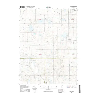
2016 Map of Silver Lake
USGS Topo · Published 2016About this map
The town of Silver Lake sits at the heart of this Indiana lake country, where a dense network of glacial basins and agricultural drainage ditches defines the landscape of Kosciusko, Fulton, and Wabash counties. The area is marked by a legacy of rural burial grounds, including Germantown Cem and Franklin Cem, which anchor the surrounding farmsteads. To the north, Claypool serves as a local hub near Caldwell Lake and Jamison Lake, while the small settlement of Disko rests on the southern border along Kroft Ditch. The complex hydrology of the region is evident in the numerous water bodies like Beaver Dam Lake, Loon Lake, and Diamond Lake, many of which are interconnected by engineered waterways such as Eaton Ditch and Lautzenhiser Ditch. This grid of section lines and ditches illustrates the systematic effort to manage the high water table for productive farming in the mid-2010s.
Find a feature on this map
77 named features on this map. Tap any name to fly to it.
Don’t see what you’re looking for? This feature index may not catch every label — zoom into the map to look around manually.
Map Details
Editions of this 2016 Silver Lake Map
This is the sole edition of this map. No revisions or reprints were ever made.
Other maps of this area

1953 · Fort Wayne
USGS Topo · 1:250,000

1953 · Chicago
USGS Topo · 1:250,000

1953 · Danville
USGS Topo · 1:250,000

1953 · Muncie
USGS Topo · 1:250,000

1955 · Danville
USGS Topo · 1:250,000

1956 · Muncie
USGS Topo · 1:250,000

1956 · Danville
USGS Topo · 1:250,000

1956 · Fort Wayne
USGS Topo · 1:250,000

1957 · Chicago
USGS Topo · 1:250,000

1957 · Warsaw
USGS Topo · 1:24,000