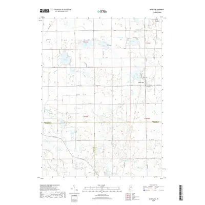
2019 Map of Silver Lake
USGS Topo · Published 2019About this map
The town of Silver Lake sits at the intersection of a complex glacial landscape and organized drainage systems along the border of Kosciusko, Fulton, and Wabash Counties. This 2019 survey documents a region defined by its numerous named water bodies, including North Little Lake, South Little Lake, and Diamond Lake. The drainage network, featuring Merrit Ditch, Silveus Ditch, and Eaton Ditch, illustrates the agricultural transformation of the Indiana wetlands. For genealogists, the map preserves the locations of several burial grounds such as Lakeview Cem, Franklin Cem, and Germantown Cem. The settlement pattern remains centered on the rail-aligned community of Claypool and the crossroads at Disko. Smaller landmarks like Beaver Dam Lake and Yellow Creek Lake are connected by a grid of county roads, reflecting the enduring rural character of this northern Indiana lake country.
Find a feature on this map
79 named features on this map. Tap any name to fly to it.
Don’t see what you’re looking for? This feature index may not catch every label — zoom into the map to look around manually.
Map Details
Editions of this 2019 Silver Lake Map
This is the sole edition of this map. No revisions or reprints were ever made.
Other maps of this area

1953 · Fort Wayne
USGS Topo · 1:250,000

1953 · Chicago
USGS Topo · 1:250,000

1953 · Danville
USGS Topo · 1:250,000

1953 · Muncie
USGS Topo · 1:250,000

1955 · Danville
USGS Topo · 1:250,000

1956 · Muncie
USGS Topo · 1:250,000

1956 · Danville
USGS Topo · 1:250,000

1956 · Fort Wayne
USGS Topo · 1:250,000

1957 · Chicago
USGS Topo · 1:250,000

1957 · Warsaw
USGS Topo · 1:24,000