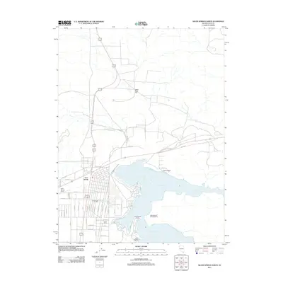
2011 Map of Silver Springs North
USGS Topo · Published 2011About this map
Silver Springs serves as the focal point of this high-desert landscape, situated where the major thoroughfares of Alt 50 and Alt 95 intersect. The settlement's layout is defined by a dense grid of residential streets including Truckee St, Tonopah St, and Winnemucca St, reflecting its growth as a hub for both aviation at the Silver Springs Airport and regional services like the Silver Springs Post Office. To the east, the shoreline of the Lahontan Reservoir dominates the geography, featuring recreational landmarks such as Virginia Beach and Fishermans Point.
Find a feature on this map
52 named features on this map. Tap any name to fly to it.
Don’t see what you’re looking for? This feature index may not catch every label — zoom into the map to look around manually.
Map Details
Editions of this 2011 Silver Springs North Map
This is the sole edition of this map. No revisions or reprints were ever made.
Other maps of this area

1890 · Wadsworth
USGS Topo · 1:125,000

1891 · Wabuska
USGS Topo · 1:125,000

1892 · Wadsworth
USGS Topo · 1:125,000

1894 · Wadsworth
USGS Topo · 1:125,000

1894 · Wabuska
USGS Topo · 1:125,000

1957 · Churchill Butte
USGS Topo · 1:62,500

1957 · Two Tips
USGS Topo · 1:62,500

1957 · Wadsworth
USGS Topo · 1:62,500

1957 · Silver Springs
USGS Topo · 1:62,500

1957 · Reno
USGS Topo · 1:250,000